Save Passamaquoddy Bay
Alliance to Protect the Quoddy Region
US
Canada
Passamaquoddy

|
Loading
|
"For much of the state of Maine, the environment is the economy" |
|
|
|
|
|
|
|
|
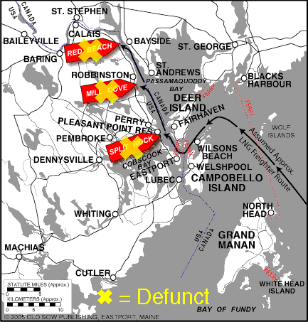
Greater Passamaquoddy Bay Area Map
with
Proposed LNG Sites
Split Rock, Mill Cove & Red Beach
Proposed Sites Flagged
Split Rock site defunct — Quoddy Bay LNG's second proposed site (see Gleason Cove proposed site map, below). Quoddy Bay LNG evicted from federal permitting by FERC after failing to answer FERC's technical questions for one year; lease cancelled by Passamaquoddy Tribal Government & US Department of Interior Bureau of Indian Affairs (BIA).
Red Beach, Calais site defunct — Calais LNG evicted from federal permitting by FERC after loss of option to purchase and loss of venture capital investor Goldman Sachs.
![]() Download 3-site 6" x 6" Map (300 lpi) in PDF Adobe Reader format.
Download 3-site 6" x 6" Map (300 lpi) in PDF Adobe Reader format.
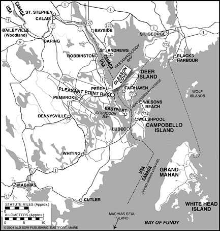
Gleason Cove
Proposed Site Flagged
(First Quoddy Bay LNG Site Defeated by Town of Perry Vote)
Add our banner to your webpage: ![]()
Read about the effort to Fix FERC: